Town Data
Town Data
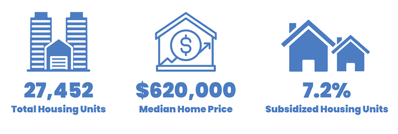
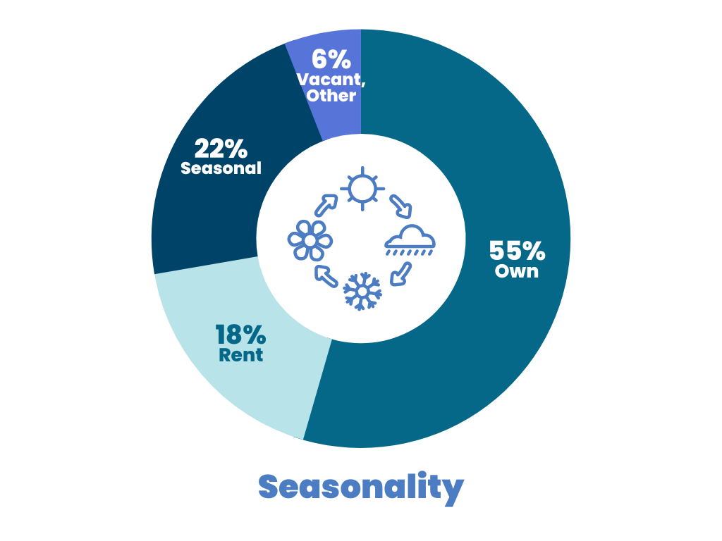
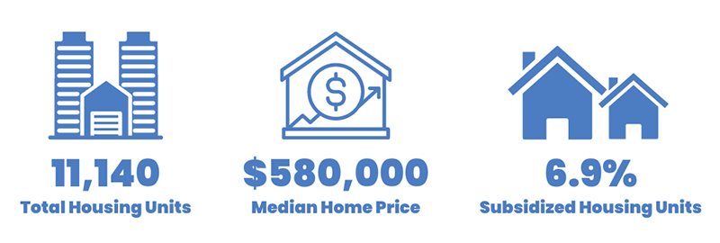
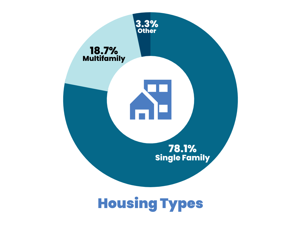
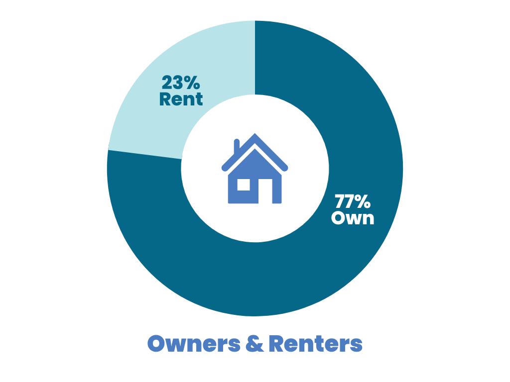
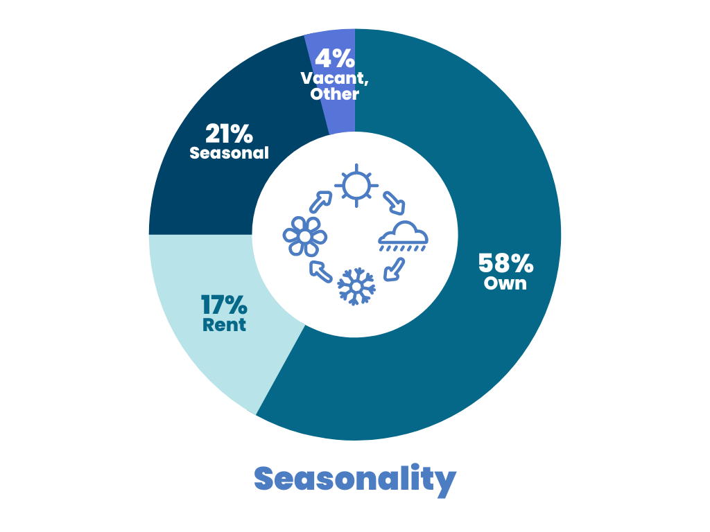
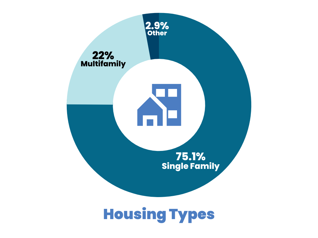
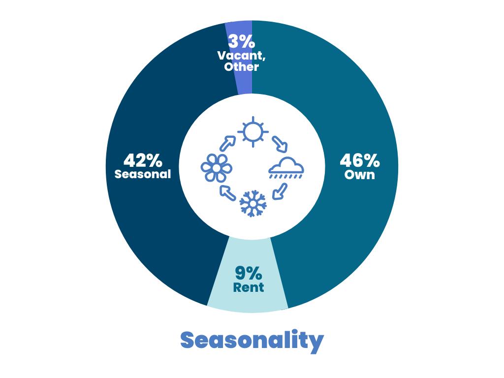
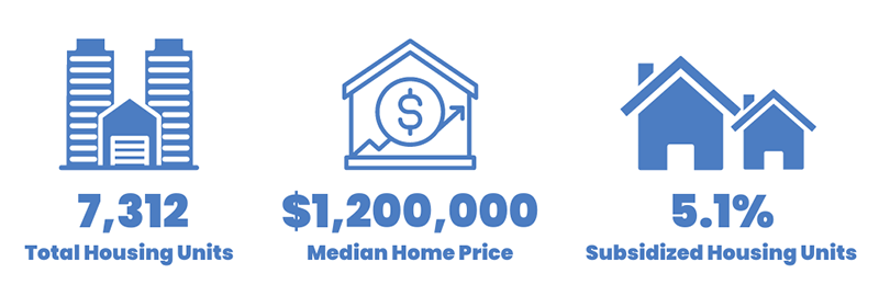
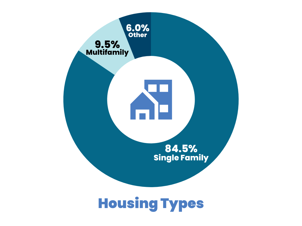
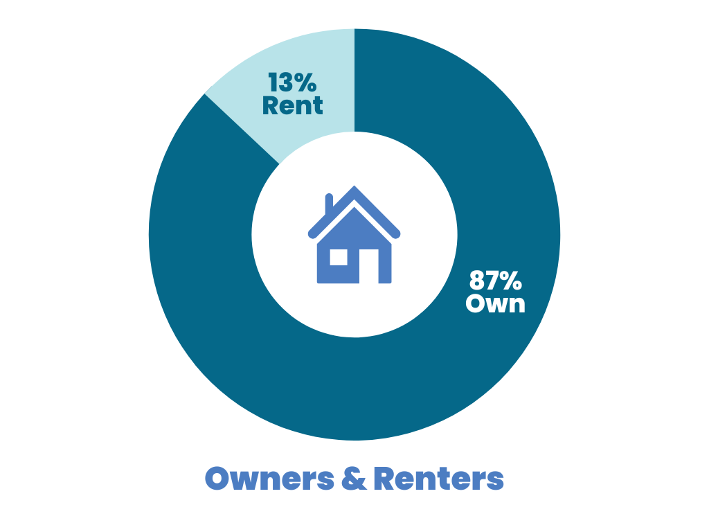
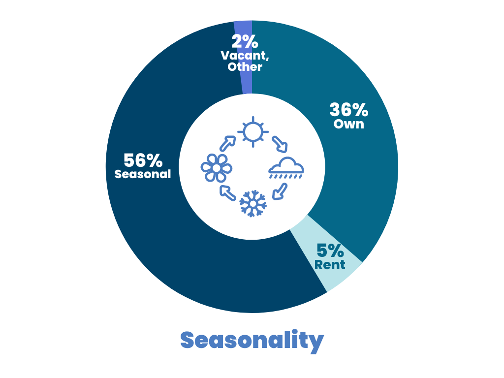
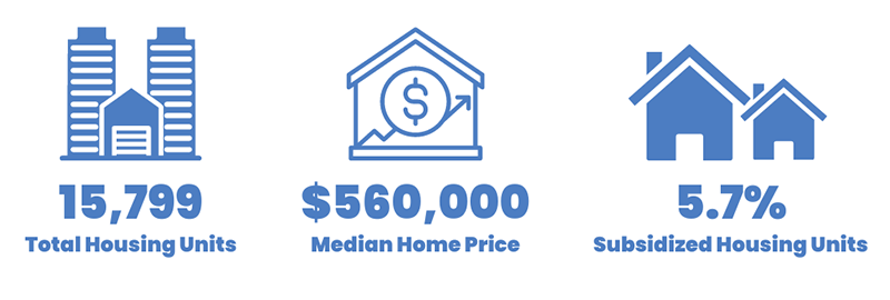
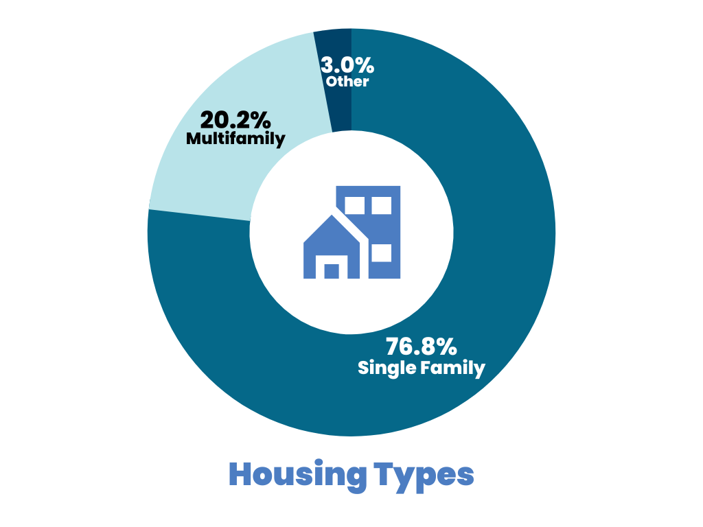
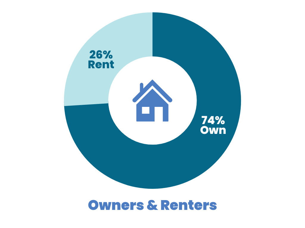
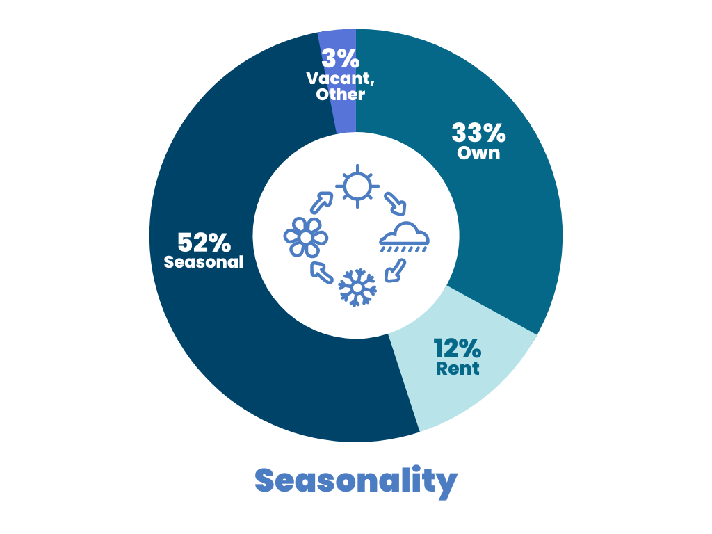
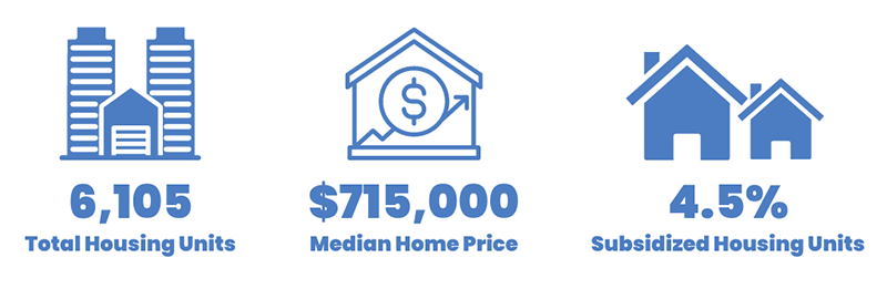
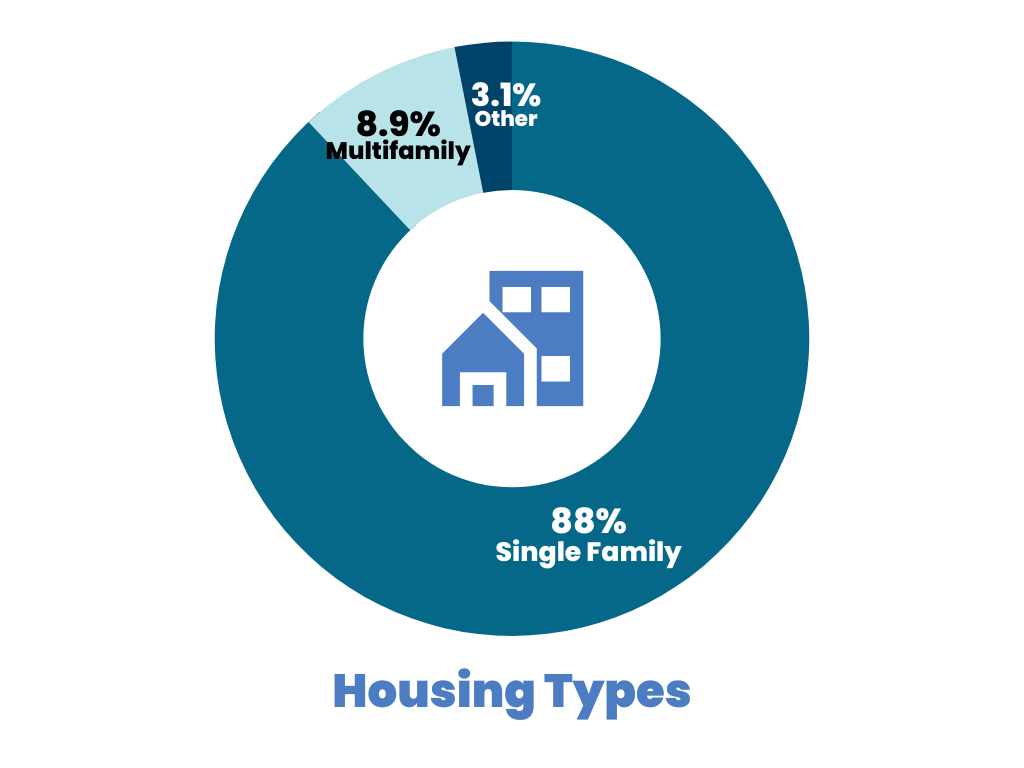
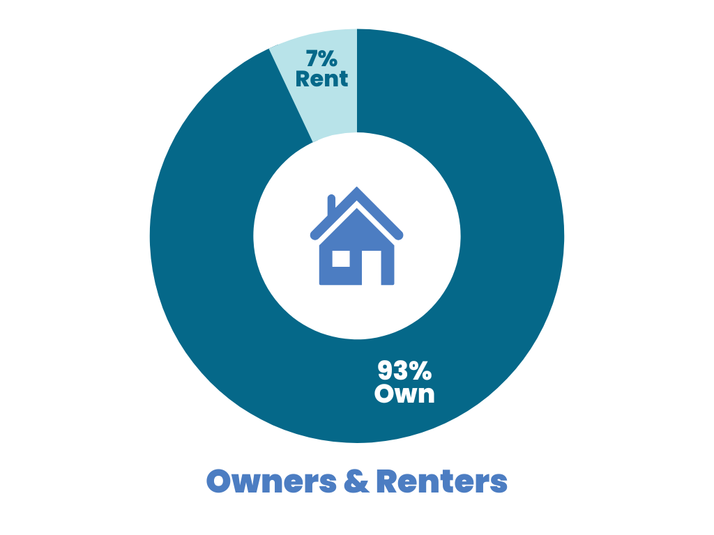
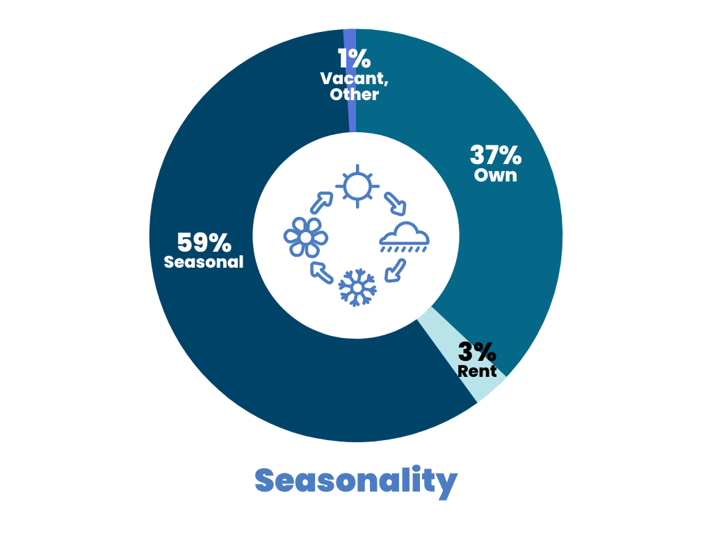
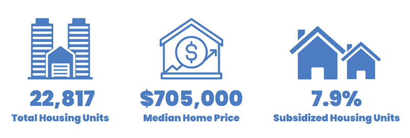
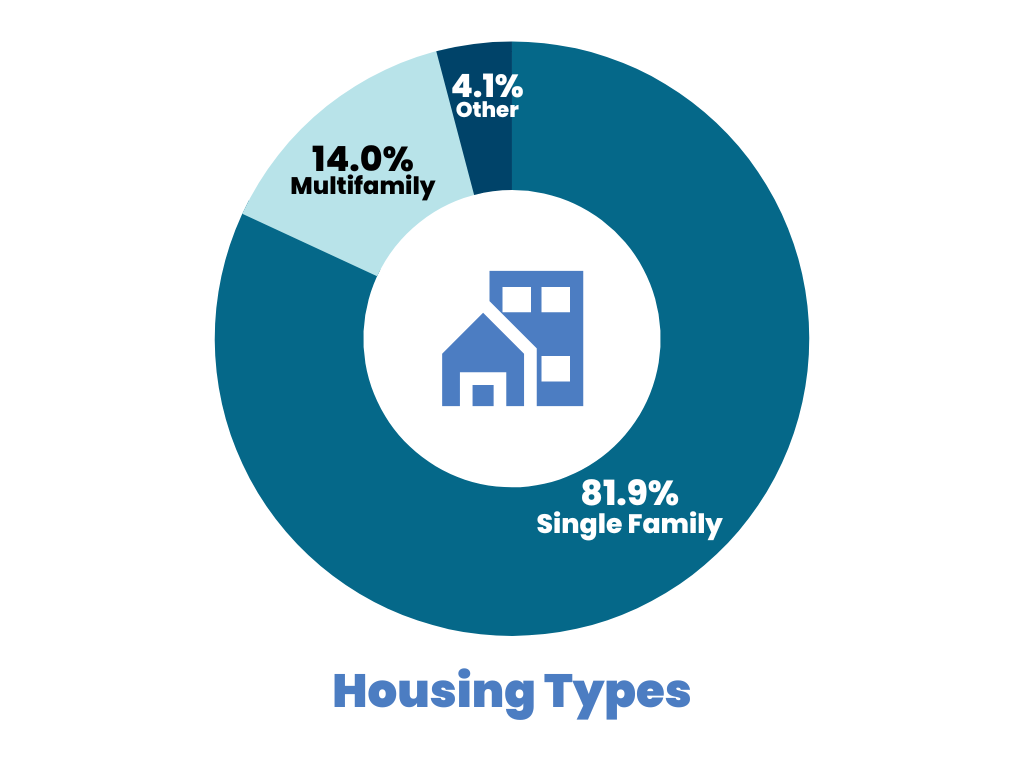
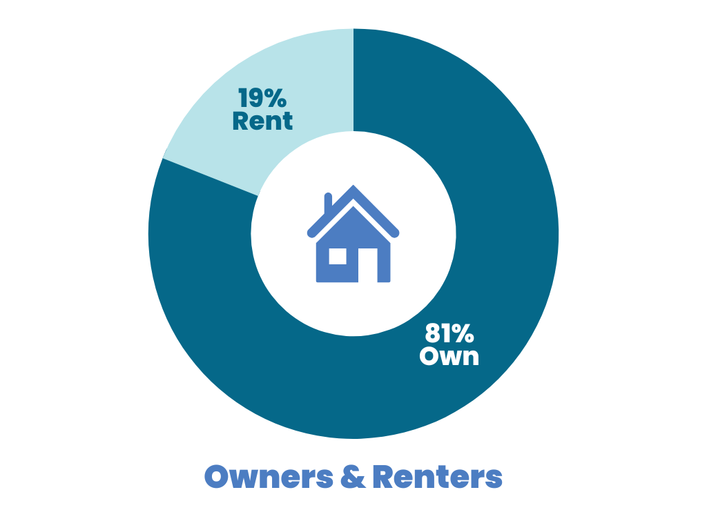
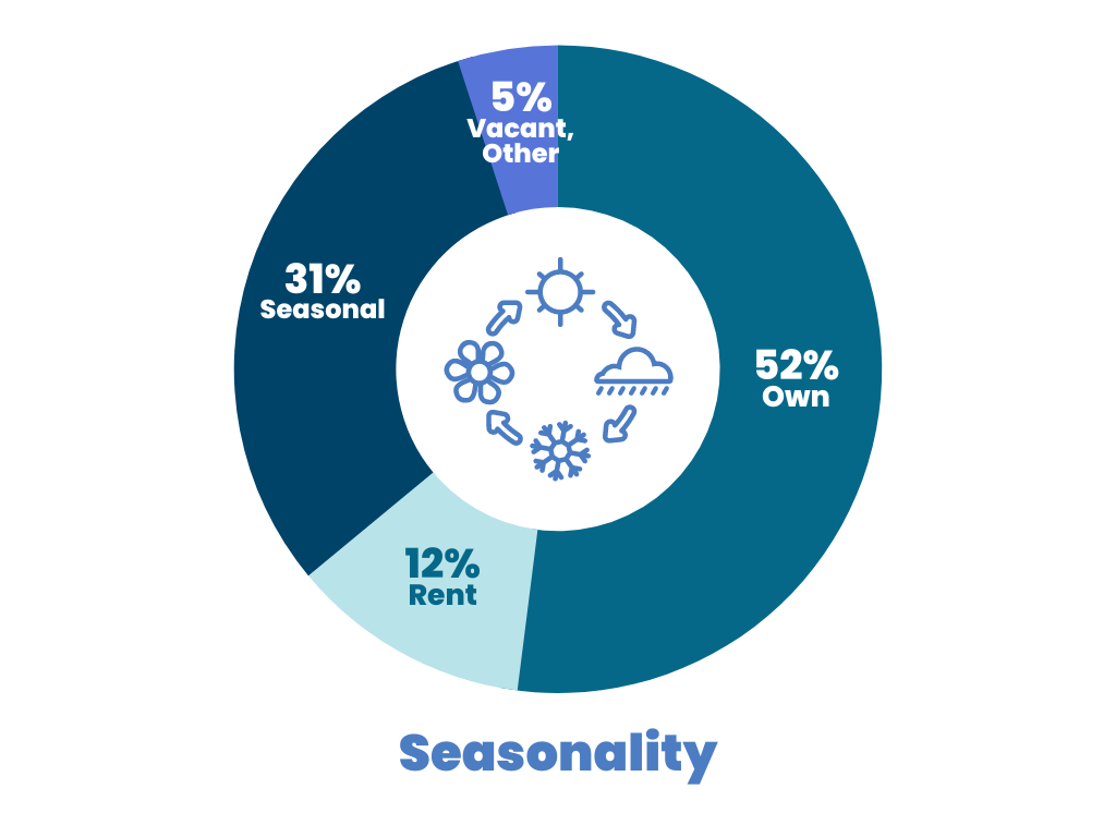
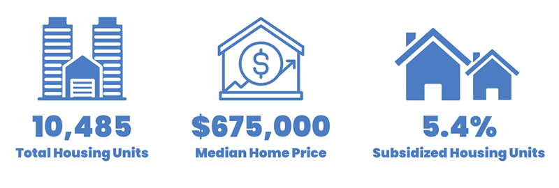
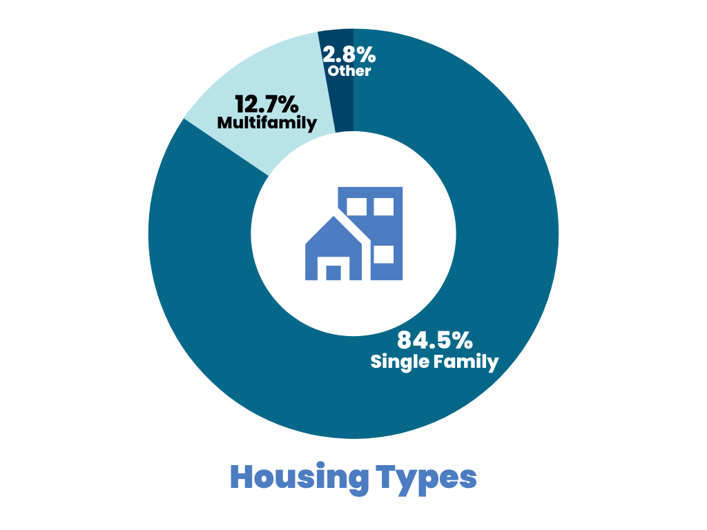
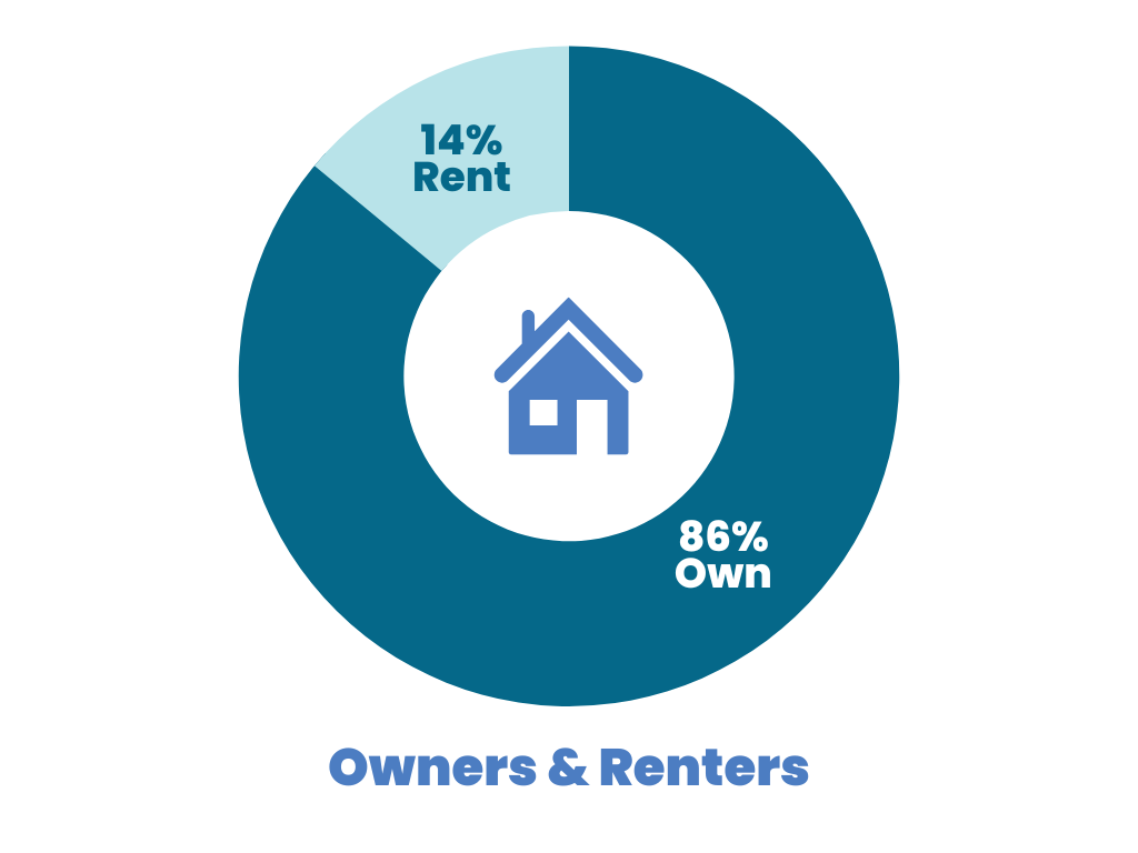
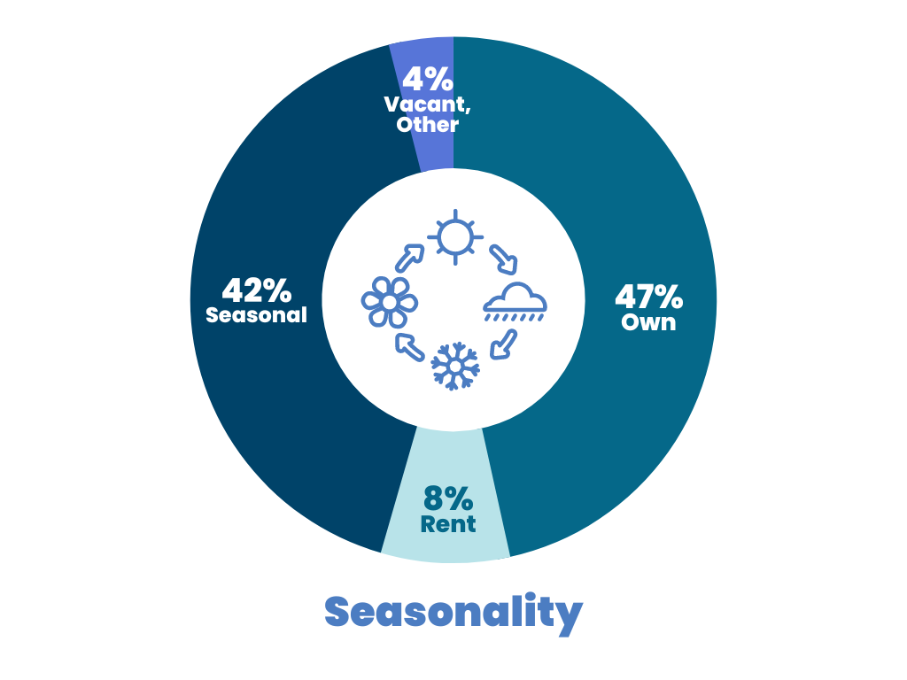
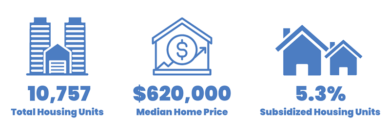
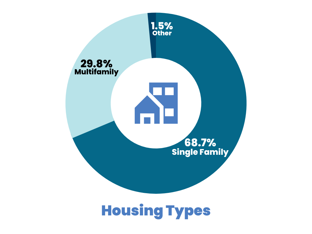
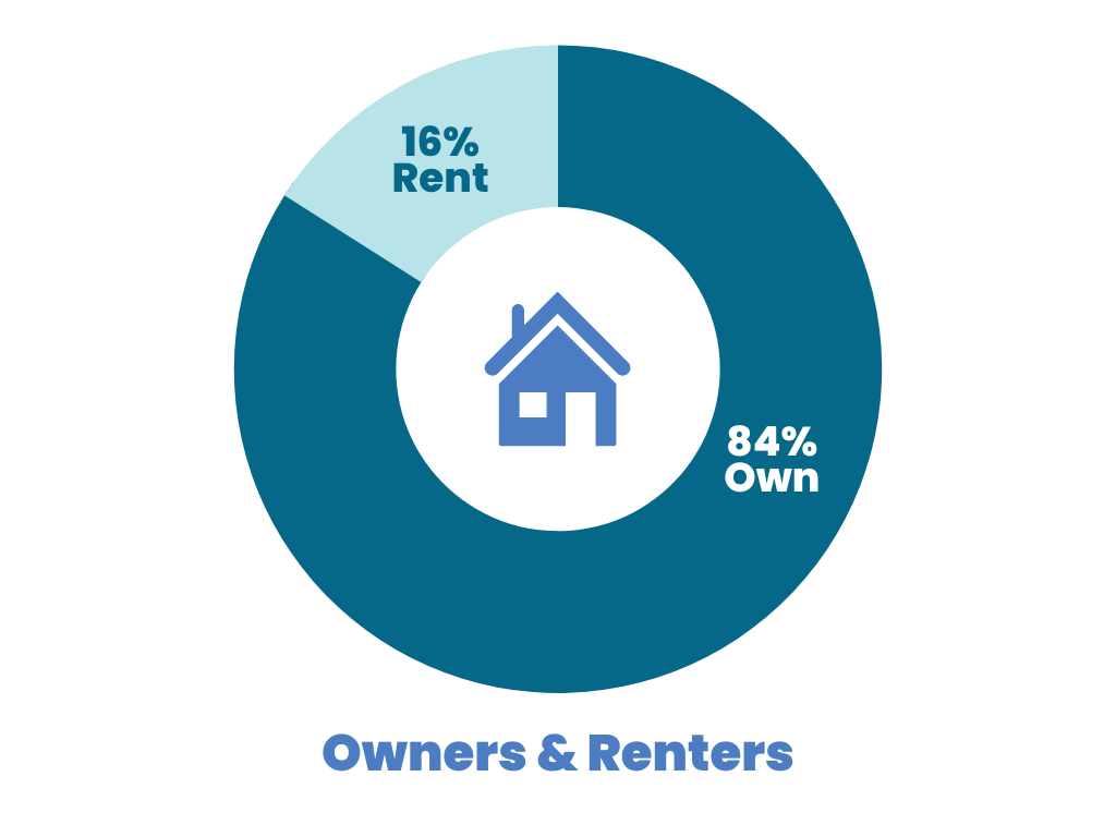
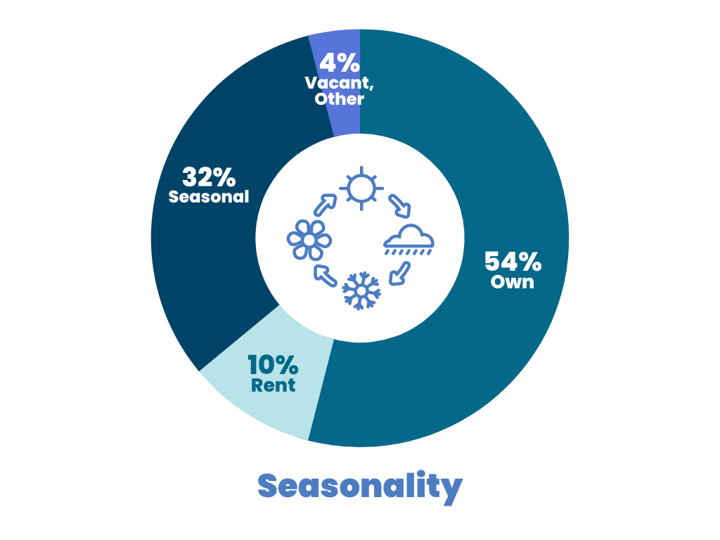
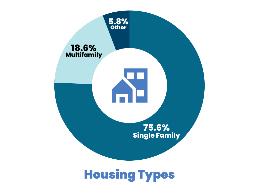
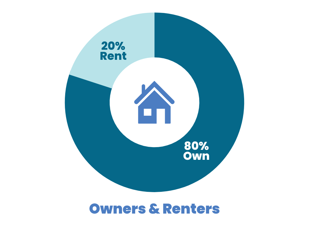
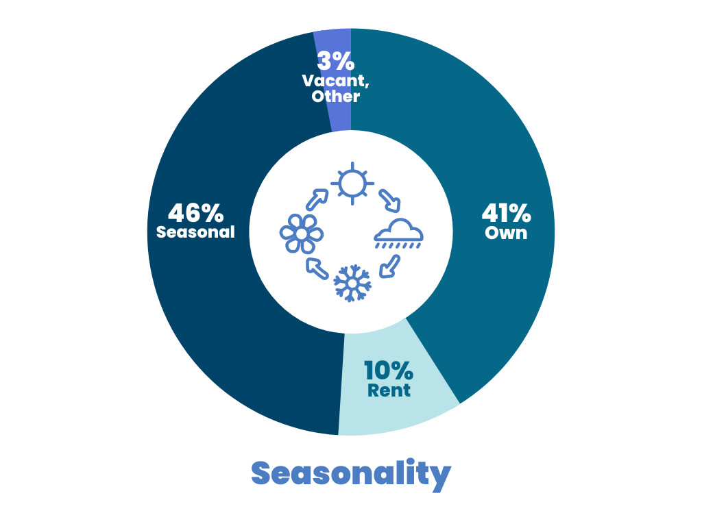
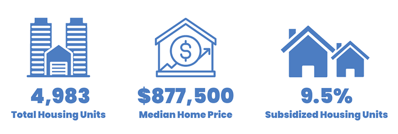
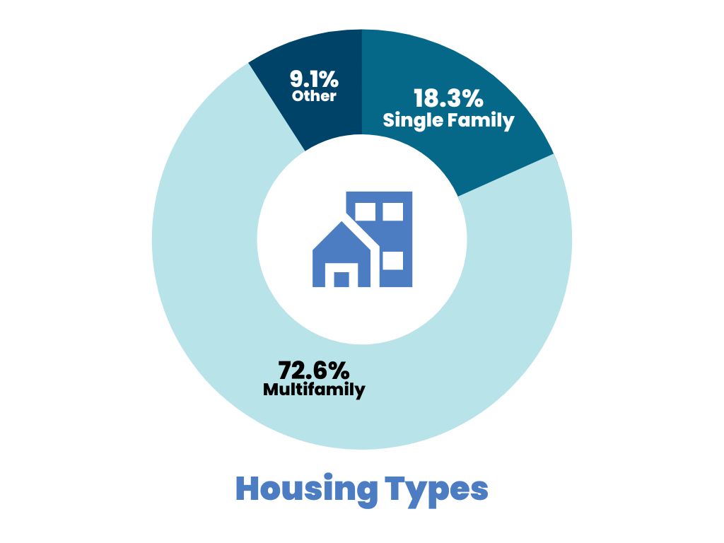
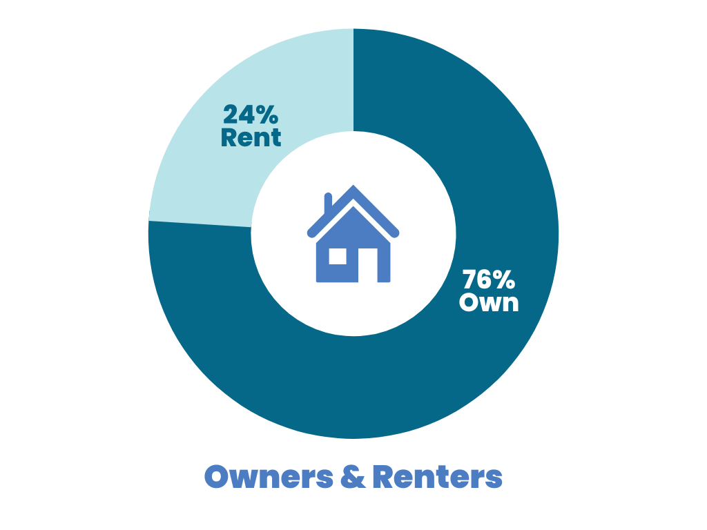
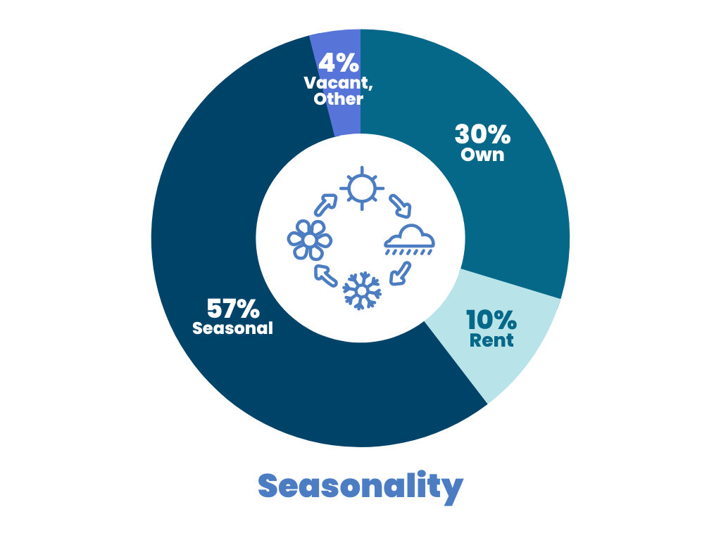
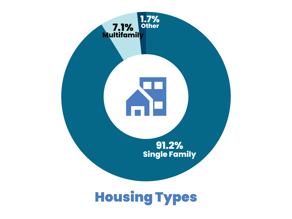
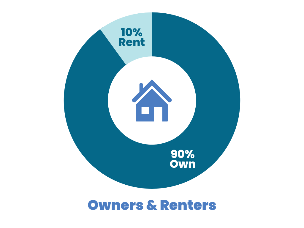
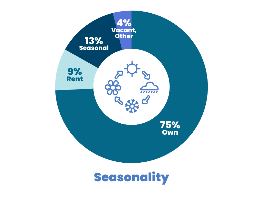
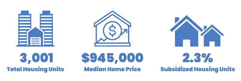
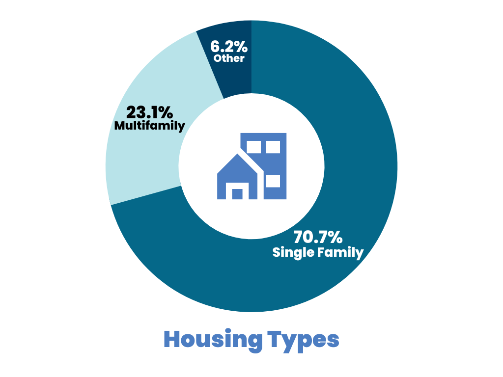
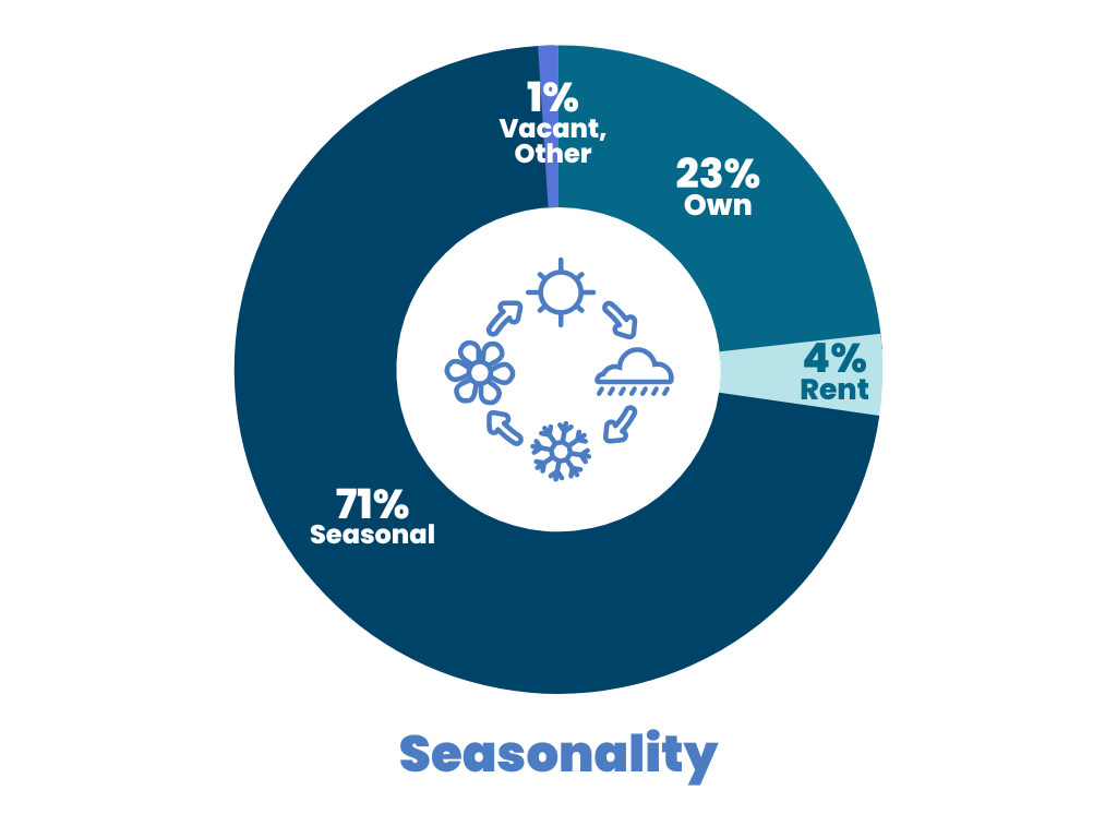
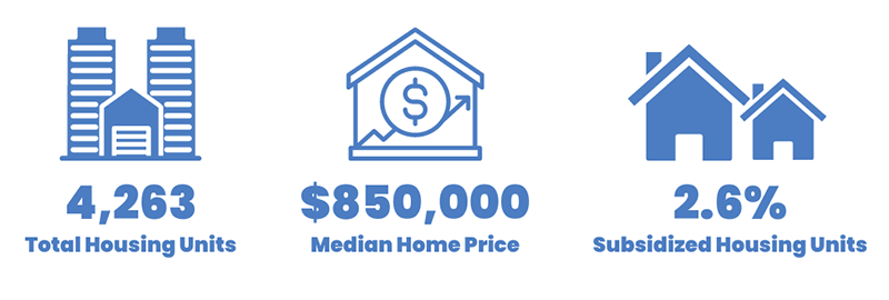
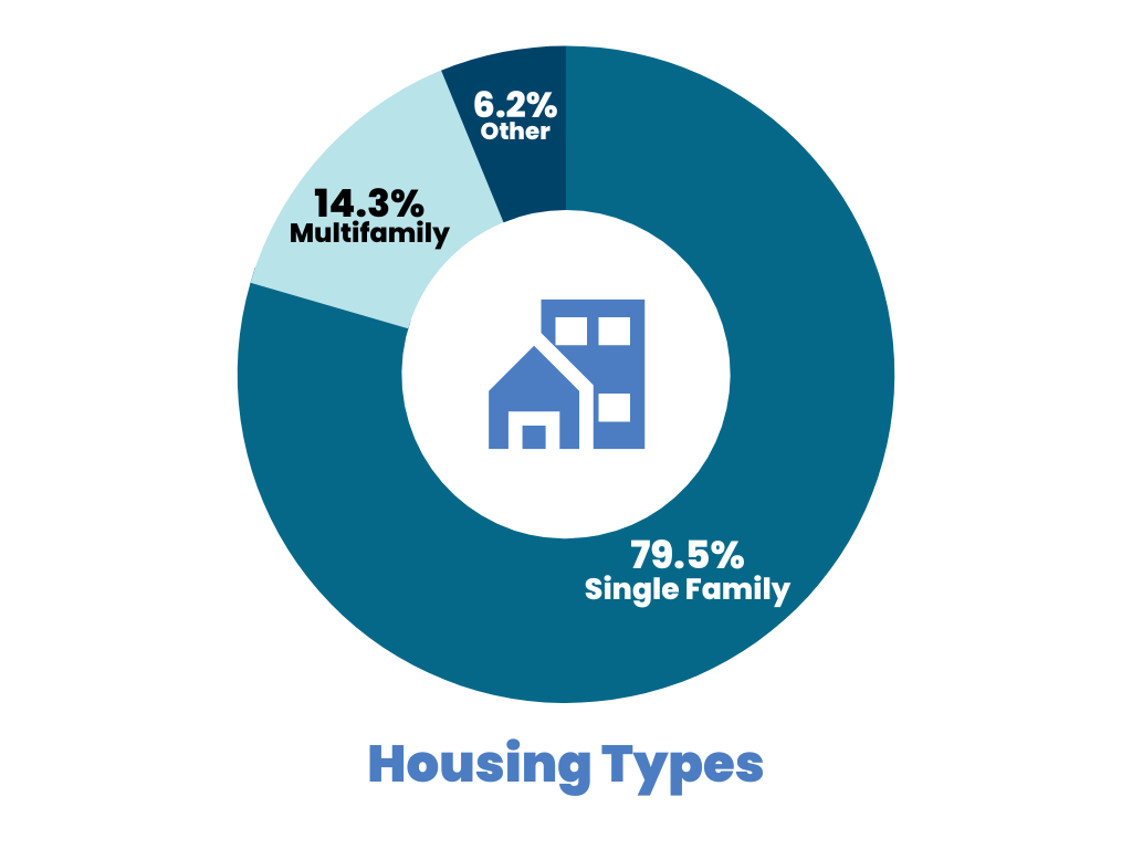
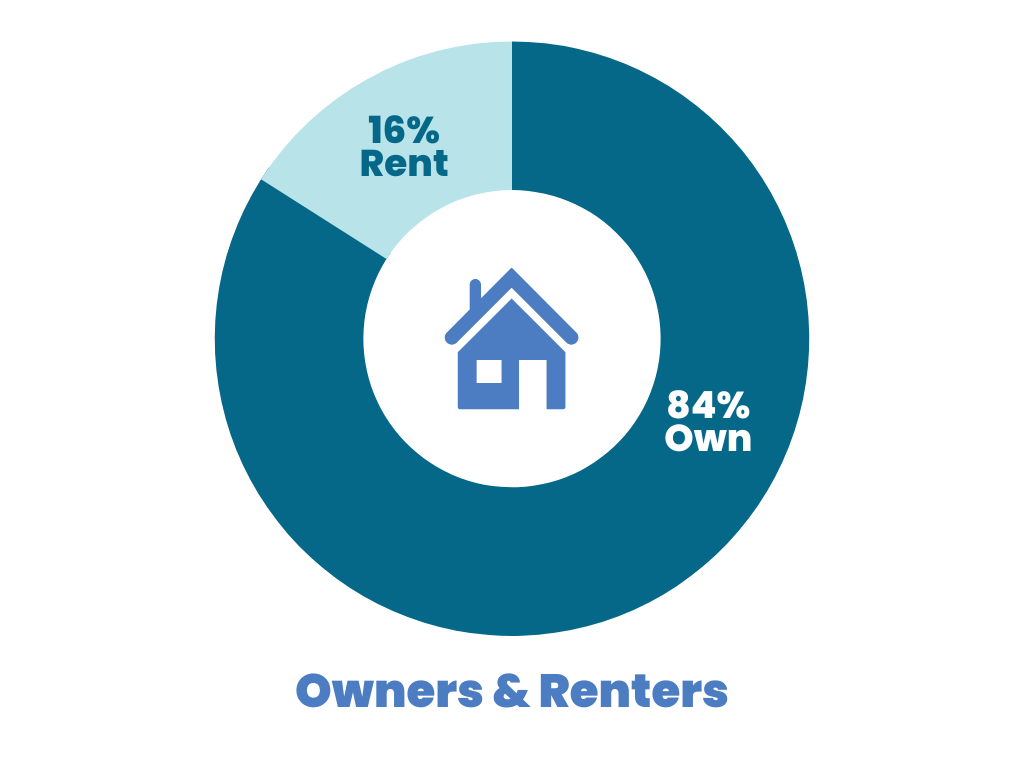
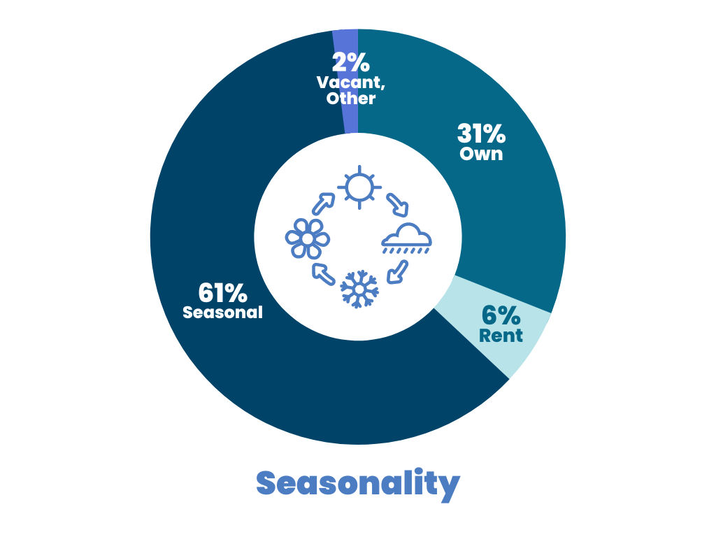
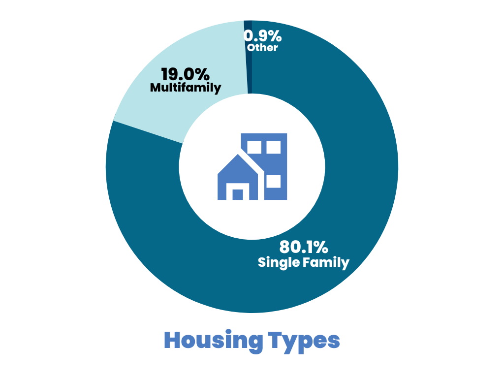
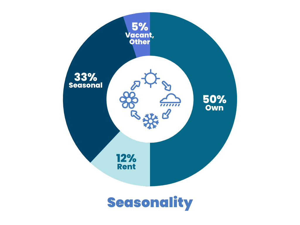
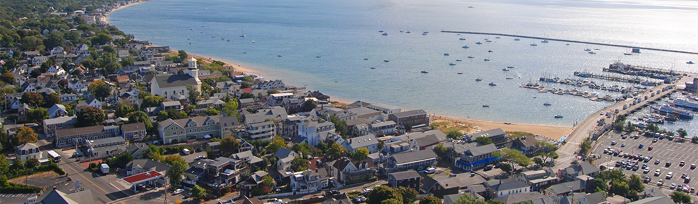
Each Cape town has a unique combination of characteristics that influence how much housing is available to year-round residents. Check out the statistics for each town below. The pie charts are made with data compiled by the Cape Cod Commission. For more information, you can download a PDF with the full details. You can also see what land is available for new housing stock by clicking through to the Grow Smart Maps, a collaborative project between Housing Assistance and the Association to Preserve Cape Cod, or viewing the town-specific PDF.